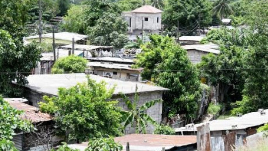
The Government through the Squatter Management Unit is incorporating geospatial technologies to assist with the management of informal settlements across the country.
Acting Director for Community Development and Planning in the Squatter Management Unit, Sherece James, says the unit has conducted several studies to make recommendations based on the social, economic and environmental impact of squatting.
She says all squatter settlements across the country have been surveyed to facilitate the creation of a geographic information systems (GIS) portal that houses data on infrastructure, the environment, and specific recommendations for each settlement.
She adds that the unit has implemented several key initiatives to prevent the rapid expansion of squatter settlements and established a regime aimed at mitigating the negative effects of squatting island-wide.
comments powered by Disqus
.jpg)


 All feeds